The map inside World Map Puzzle does not show legal or disputed borders. It is a generalized schematic world map built from Natural Earth's 1:110 million Admin 0 Countries dataset, a cartographic product that Natural Earth itself describes as suitable for schematic world maps at postcard or locator-globe size. That dataset deliberately smooths coastlines and removes small features so the geometry fits a small canvas, which is why the game can place eight recognizable country silhouettes on a compact 360 by 180 equirectangular surface. Each country path was projected offline using x equals longitude plus 180 and y equals 90 minus latitude, then rounded, simplified, and embedded into the build so the game runs without any network request, geocoding API, or live boundary service. The eight fixtures are Brazil, Argentina, South Africa, Egypt, India, China, Japan, and Australia. Natural Earth's boundaries are a cartographic dataset, not a legal ruling, and the game itself does not make any statement about sovereignty, recognition, disputed territory, maritime limits, or preferred country names. The map is appropriate for a recognition puzzle, not for navigation, surveying, cadastral work, treaty interpretation, logistics, scientific measurement, or classroom grading that requires an official political map.
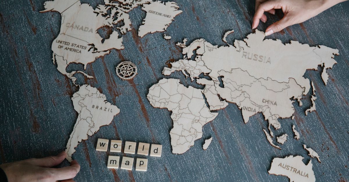
What kind of borders does the map actually show?
The borders on the puzzle map are generalized lines from a public cartographic dataset, not lines that have any legal force. Natural Earth's 1:110m Admin 0 Countries layer compresses the world's coastline and country outlines into a small, simplified shape suitable for world-scale reference graphics. The puzzle's authors took that simplified layer, projected it into a 360 by 180 equirectangular view box, rounded the coordinates to one decimal place, and applied further offline simplification so the eight paths stay small in the client bundle. The result is a map that looks like a world map but is intentionally generalized: small peninsulas disappear, islands shrink or merge, and complex borders become smooth shapes. The game does not attempt to render disputed territories, maritime boundaries, exclusive economic zones, or special administrative regions as their own entries. There is no second layer of dashed lines for contested areas, no inset for the South China Sea, no separate entry for Western Sahara, no separate island chain for the Kurils, and no maritime halo around island states. Each piece is identified by a single Natural Earth alpha-3 code and one English name, so the map cannot disagree with itself about which country a silhouette represents.
Why the eight shapes are not a political statement
The tray includes Brazil, Argentina, South Africa, Egypt, India, China, Japan, and Australia. Each one is identified by a Natural Earth alpha-3 code, an English name, a bounding box, and a label coordinate. The label coordinate becomes the center of a 44-pixel interactive target on the schematic map, and the larger control makes small or island shapes such as Japan usable with touch and keyboard without changing the visible country path. The fact that the tray names exactly those eight countries is a fixture choice, not a recognition or endorsement choice. The dataset itself, not the puzzle, decides where the coastlines and borders fall. The puzzle does not redraw, recolor, or recode any boundary, and it does not add disclaimers or footnotes because the chosen scale already speaks for itself. At 1:110 million, one centimeter on the page equals 1,100 kilometers on the ground, which is the scale where the world's smallest recognizable shapes already begin to look like dots. If you want a pixel-precise boundary, a treaty-grade coastline, or a disputed-territory overlay, the puzzle is not the right source.
| The map shows | The map does not show |
|---|---|
| Generalized country outlines from Natural Earth 1:110m | Legal rulings on sovereignty or recognition |
| One simplified path per alpha-3 country ID | Separate entries for disputed territories |
| Equirectangular projection on a 360 by 180 box | Maritime limits, EEZs, or continental shelves |
| Label coordinates as the center of 44-pixel targets | Treaty boundaries or cadastral lines |
| Eight fixed shapes embedded offline | Live map data, network requests, or geocoding APIs |
Place the eight countries on the schematic map
- Open the game and look at the tray on one side of the screen. The eight named pieces are Brazil, Argentina, South Africa, Egypt, India, China, Japan, and Australia.
- Select one piece in the tray by clicking it or moving focus to it with the Tab key. The selected piece receives a visible outline so you can track which one is active.
- Locate the matching numbered target on the schematic map. Targets are numbered rather than named, so the tray supplies the country name while the map still tests location.
- Activate the matching target by clicking it, pressing Enter or Space on a focused target, or dragging the piece onto the outline. A correct match fills the outline with a check mark and the target's accessible label reports the placed country.
- Repeat for each of the eight pieces. Each correct placement adds 125 points to your score. After the eighth correct match, your score reaches exactly 1,000 and the run is complete.
- If you drop the active piece on a wrong target, the piece does not move and you get one retry. The second wrong target creates a visible deadlock. Press Restart to begin a fresh run with the same eight fixtures.
Scoring, terminal states, and reproducibility
Each correct placement awards 125 points and a check mark, and the score only advances on a correct match. Eight correct placements add up to exactly 1,000. Two incorrect placements produce a visible deadlock, after which the score, placed IDs, and the board itself are frozen until you press Restart. Because every round uses the same sourced fixture, local Playwright and production Playwright can repeat the exact eight placements and verify the same 1,000-point outcome instead of relying on a random map. The path strings, alpha-3 identifiers, English names, bounding boxes, and label coordinates all come from the same offline dataset, so the run is reproducible across browsers and machines. The game does not ask for location permission, does not upload answers, and does not call any analytics endpoint. Everything happens locally in your browser, which is why the build is small enough to embed and quick enough to start without a server round trip. Independent tests check the eight source-derived label points, unique identifiers, unique paths, bounding boxes, full placement score, wrong-target behavior, and terminal-state freeze, so every claim about the run is auditable rather than asserted.
What the map is for, and what it isn't
Use the game for quick country-shape and world-position practice. It is a compact recognition puzzle that helps you associate Brazil's silhouette with South America, Australia's silhouette with the Southern Hemisphere, and Japan's silhouette with the western edge of the Pacific. It does not test capitals, flags, subdivisions, overseas territories, disputed areas, precise scale, or every recognized country. The fixed eight-country scope is intentionally smaller than a full atlas, and the simplified geometry is intentionally smaller than a reference map. If you need a map that distinguishes recognized states from disputed ones, draws dashed lines for contested areas, or names capitals and subdivisions, you should consult a current political reference map, an official government source, or a publisher's political atlas. The schematic map in the puzzle is a learning aid, not an authoritative document. Once you understand that limit, the eight placements become a clean, deterministic practice set with the same shapes, the same targets, the same 1,000-point ceiling, and the same deadlock behavior every run.